Updated on December 12, 2016
St. Augustine to Cape Canaveral and the town of Cocoa
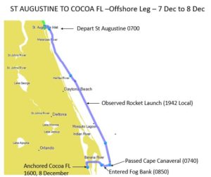
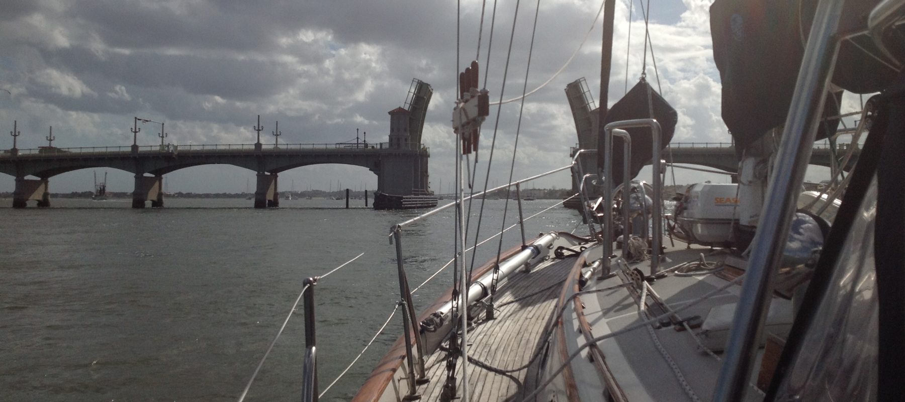
On December 7th we sailed out of St Augustine on the edge of the morning tide, almost at slack water, timing our departure to bridge opening at 0730. Our exit was uneventful, we cast off the line attaching us to the mooring ball, went through the Bridge of Lions, and turn right when we saw the Atlantic Ocean.
Passing the St Augustine Sea Buoy at 10am, we turned south and raised the mainsail and unfurled the genoa. Winds were from the north at about 10 knots and we began a pleasant sail south, making an average of 4.7 knots, plenty to make our next stop at Port Canaveral.
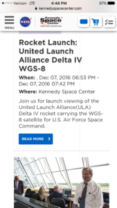
We had done some research and knew that there would be a launch of a Delta IV rocket with an Air Force satellite at 7:42pm (1942) from the Kennedy Space Center on Cape Canaveral. We began to get excited as we thought we would be in a good position to see.
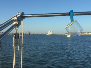
At 1730, we observed sunset (and it was one of the best we have seen, with very bright pinks silhouetting large building of Daytona Beach and deep purples off of the clouds on the western horizon. We were traveling in company with a sailing vessel by the name of “Good Karma”.
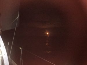
Right on schedule, while we were still some 50 nautical miles from Cape Canaveral, with the night lit by a partial moon on the east, a bright light appeared in the west, low on the horizon. The light was so bright it reflected off the clouds. It rose to about 70 degrees above the horizon and then disappeared in space. I heard from folks that were watching from the beach it was one of the best launches for viewing they had ever seen.
At about midnight, the winds died and we started the engine. At 0400, the wind shifted to the West at about 10 knots. We stopped the engine and continued with the reefed main alone.
At 0600, we began to see a lot of fishing boats heading for the artificial reefs. After sunrise at 7am, we turned west for the final run to Port Canaveral channel.
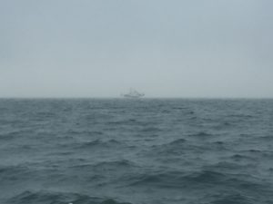
At 0850 we experienced a first on Sophia….we ran into a thick fog bank. We began sounding fog signals, lit off the radar, assigning Elena as the radar watch, and took in our sails, lit off the radar. We passed the NOAA ship “Nancy Foster” at 1 nautical mile and never saw her. By 0930, the fog was beginning to burn off and we confirmed with had least one mile visibility. We secured the radar watch and ceased sounding fog signal.
AT 1030 we entered the Port Canaveral Channel. “Good Karma” reappeared and passed us in the channel. We got to the first of two bridges, just before a set of locks, both of which needed to be opened. The bridge reported they were inoperable and we would have to hold. We held in front of the bridge, maintaining a position just off the shore, for an hour. The bridge opened and we went immediately into the locks.
We continued on to the Port Canaveral Barge canal across the Banana River, with its shallow (9 foot) and then on to the Indian River and the ICW, passing the second bascule bridge along the way, where we had to wait for the scheduled opening.
We traveled a couple of miles south and anchored at 1600 off the little town of Cocoa, FL, putting out a healthy 100 foot of chain in 9 feet of water, as we expected to be here a few days and some hefty winds were forecasted.